Meteorologists with the National Oceanic and Atmospheric Administration released the agency’s annual snowfall predictions, which may cause some in the country’s less snowy regions to dust off their shovels.
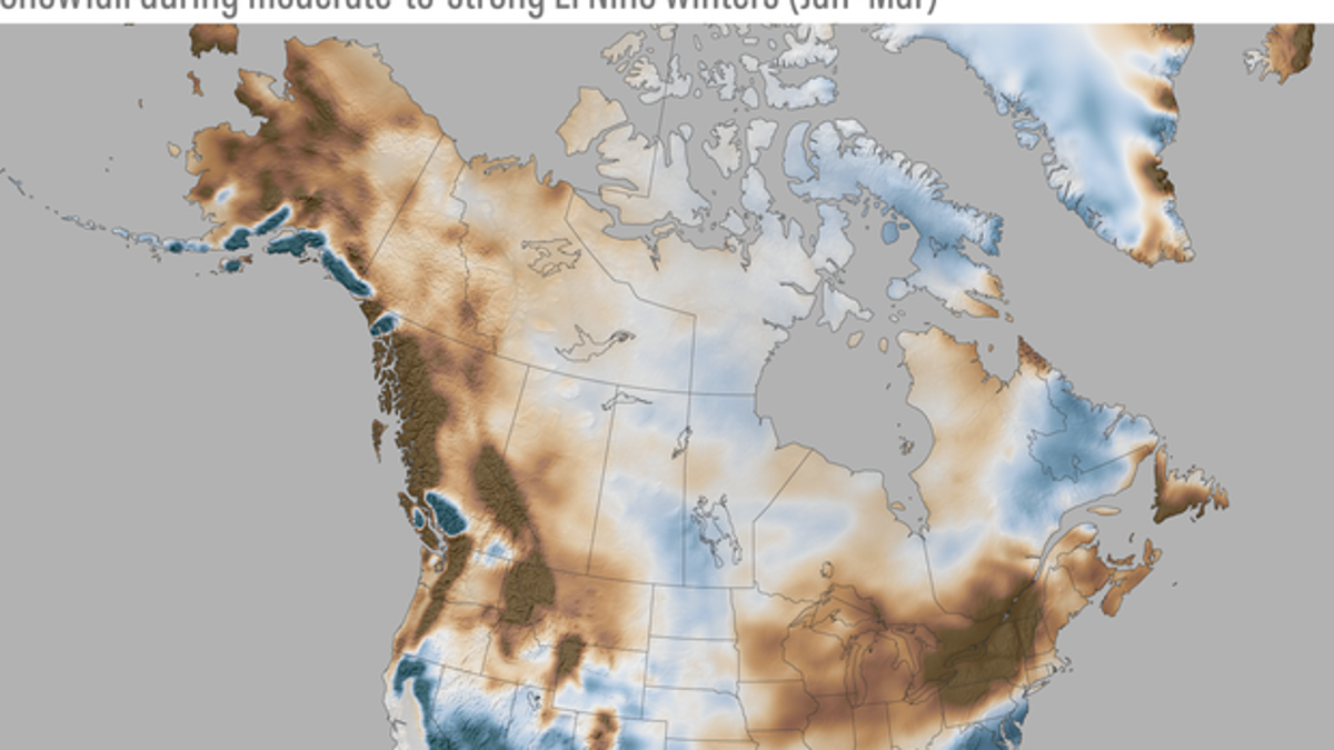
An NOAA map released last week shows that the typically snowy Great Lakes region and Northeastern U.S. might see less snow this winter, while the Southern U.S. and Great Plains could be in for more than average snowfall.
The seemingly strange winter prediction is the result of El Niño, a tropical weather pattern originating in the Pacific that is expected to be “moderate-to-strong” during the 2023-2024 winter, according to a blog post on the NOAA website.
SNOW PILES UP IN NORTH DAKOTA AS REGION’S FIRST MAJOR SNOWSTORM OF THE SEASON MOVES EASTWARD
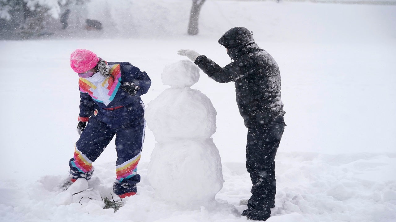
Denver residents build a snowman. (AP)
“The jet stream tends to extend eastward and shift southward during El Niño winters. You can think of the jet stream as a river of air, which carries more moisture and precipitation along the southern tier of the United States during El Niño,” reads the post, which was authored by Michelle L’Heureux and Brian Brettschneider.
“Obviously, snowfall is limited in its southernmost reaches because it needs to be cold enough to snow, so the effects are strongest in the higher and colder elevations of the West,” the post continues. “To the north, however, there is a reduction in snowfall (brown shading), especially around the Great Lakes, interior New England, the northern Rockies and Pacific Northwest.”

Snowfall during moderate-to-strong El Niño winters (January-March) compared to the 1991-2020 average (after the long-term trend has been removed). Blue colors show more snow than average; brown shows less snow than average. NOAA Climate.gov map, based on ERA5 data from 1959-2023 analyzed by Michelle LHeureux. (NOAA Climate.gov)
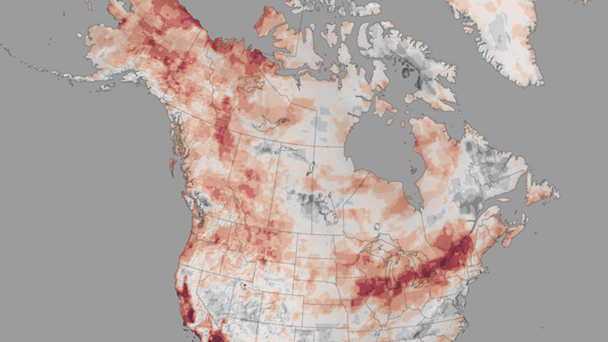
To come to their predictions, the scientists studied previous moderate-to-strong El Niño winters to get a sense of what the upcoming winter may look like. The researchers included a map of the previous 13 similar winters that were studied to make the predictions, showing which regions were most heavily affected by moderate-to-strong El Niño winters in the past. Like the 2023-24 predictions, the regions that seemingly produce dependably less snowfall under similar conditions include the Great Lakes and New England regions.

Number of years with below-average snowfall during the 13 moderate-to-strong El Niño winters (January-March average) since 1959. Red shows locations where more than half the years had below-average snowfall; gray areas below-average snowfall less than half the time. NOAA Climate.gov map, based on ERA5 data from 1959-2023 analyzed by Michelle LHeureux. (NOAA Climate.gov)
But the post also cautions that the maps are only a best guess, noting that El Niño can only “nudge” the weather in a more likely direction.
CLICK HERE TO GET THE FOX NEWS APP
“There’s S(no)w guarantee in this business,” the post quips. “El Niño nudges the odds in favor of certain climate outcomes, but never ensures them.”


